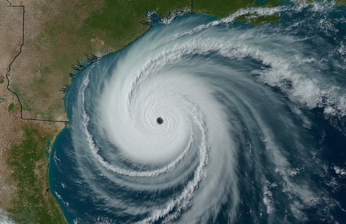
In its special warning issued at 1:00 p.m., local time, the Cuban Institute of Meteorology (INSMET) reported that by the end of the morning, Milton had gained maximum sustained winds of 260 kilometers per hour and its pressure had dropped to 925 hectopascals.
During the next 12 to 24 hours, the hurricane is expected to move in a similar direction, inclining its path to the east, passing very close to or over the Yucatan Peninsula.
Forecast models indicate that on Tuesday, the hurricane will turn northeast, increasing its speed to approach the west coast of the Florida Peninsula in Wednesday afternoon-evening.
The wide circulation of Hurricane Milton and the feeding bands associated with this system will maintain instability in western Cuba with showers and rain from late tonight, INSMET warned.
It added that taking into account the hurricane’s trajectory over the southeast of the Gulf of Mexico and its proximity to western Cuba, there will be winds from the south to the southwest this afternoon, with speeds ranging between 15 and 30 kilometers per hour in that region.
On Tuesday, sustained winds from Pinar del Río to Mayabeque provinces will be stronger, with speeds between 25 and 40 kilometers per hour and up to 50 kilometers per hour, with higher gusts in Pinar del Río from the end of the afternoon.
 Escambray ENGLISH EDITION


Escambray reserves the right to publish comments.