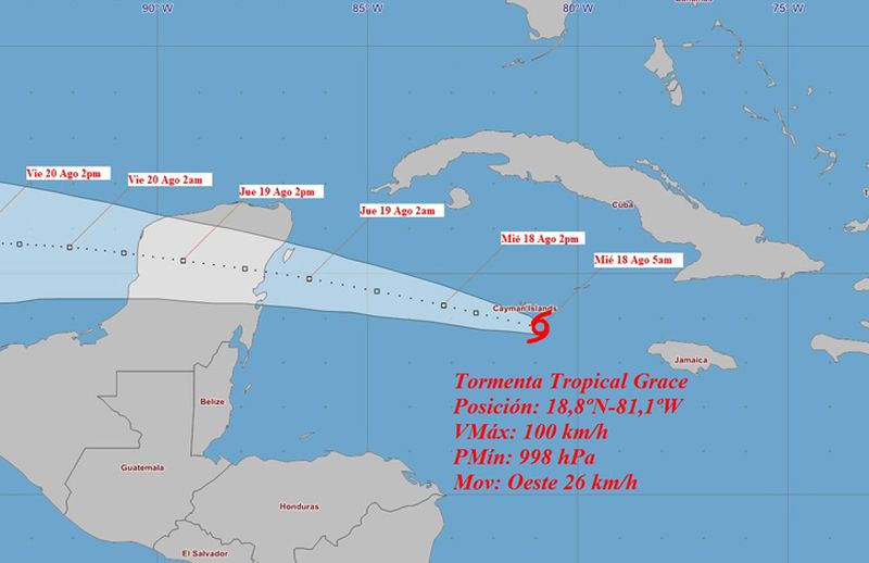
The Institute of Meteorology reports in its Tropical Cyclone Warning No. 14 that in the early morning tropical storm Grace has continued to intensify and now has maximum sustained winds of 100 km/h.
Its minimum pressure has decreased to 998 hPa as it approached the Cayman Islands in the western Caribbean Sea and is still heading west, now at 26 km/h.
In the next 12 to 24 hours, Grace will continue tracking west to west northwest at a similar speed, moving very near the Cayman Islands and approaching the Yucatan peninsula late tonight or early Thursday morning. It is forecast to strengthen into a hurricane later today prior to the center reaching the Yucatan Peninsula.
Satellite and radar images show wide areas of showers concentrated around Grace’s center and some outer bands crossing over eastern and central Cuba.
Heavy rains are expected in these regions and will start affecting western Cuba together with swells in low-lying areas along the southern coast of the Isle of Youth and the province of Pinar del Rio.
The next tropical cyclone warning for Grace will be issued at noon on Wednesday (today).
 Escambray ENGLISH EDITION


Escambray reserves the right to publish comments.